

The Intelligence Layer for the World's Trees
Treeable combines satellite imagery, aerial imagery, and proprietary GeoAI to continuously observe, understand, and manage individual trees at planetary scale.
Planetary scale
3.2 trillion trees.
Zero shared intelligence.
Trees shape our infrastructure, our cities, our risk, and our climate — yet they exist outside the systems that run the modern world. Treeable turns every individual tree into a live, queryable object of intelligence.
3.2T
Trees on Earth
Living, growing, and largely unmeasured
<0.1%
Individually tracked
The vast majority remain invisible to systems
1
Object model per tree
Location, species, condition, risk, and change

A new category
We are defining Tree Intelligence
The discipline of mapping and understanding every individual tree on Earth — the intelligence layer between raw earth observation and the decisions of the physical world.
The TreeINT® Platform
One intelligence layer. Three operating modes.
Three products that build on each other — a live tree map, the risk models it feeds, and the field operations that act on them.
Observation Layer
TreeINT | DETECT
Detect. Classify. Monitor.
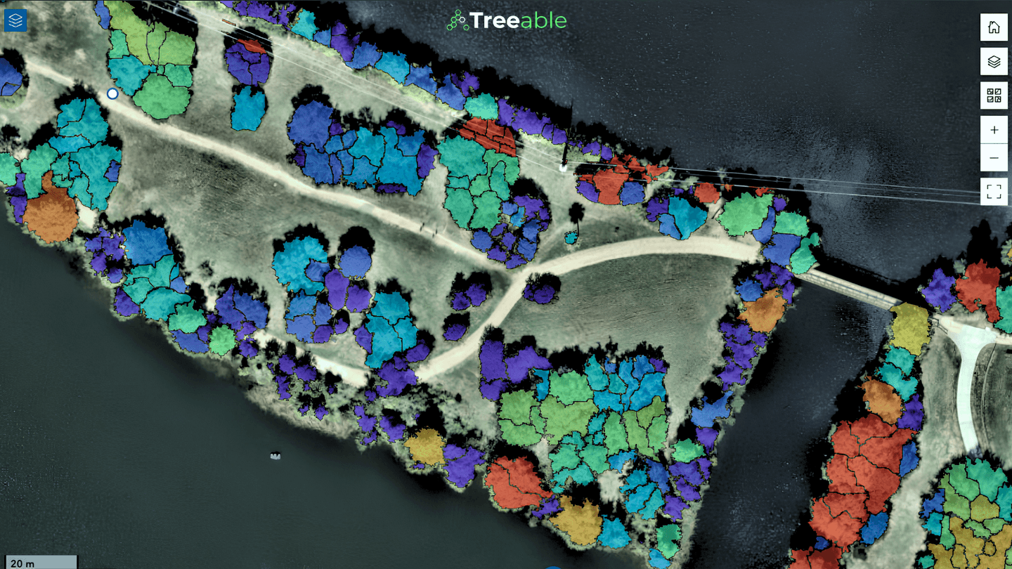
GeoAI tree mapping from satellite, aerial, LiDAR, and hyperspectral data. Detect individual trees at planetary scale, classify their operational context, and monitor condition and change over time.
Per-tree segmentation
Detect and map individual tree locations at scale.
Classification models
Street, building-adjacent, right-of-way, boundary, and more.
Condition ratings
Healthy, fair, poor, dead, or stressed canopy.
Change detection
Surface emerging risk before it becomes a cost.
Delivered as
Modeling Layer
TreeINT | DECIDE
Analyze. Decide. Act.
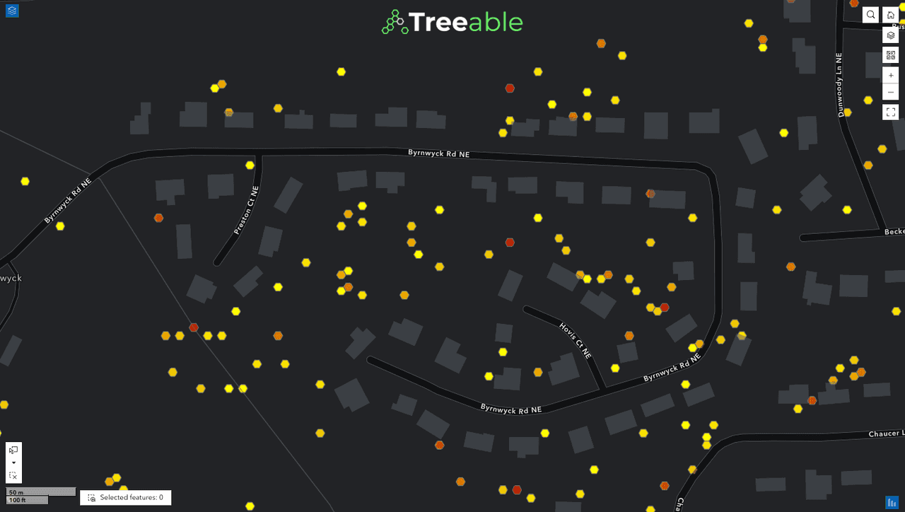
Geospatial risk modeling plus decision intelligence. DECIDE converts tree observations into risk scores, budget scenarios, and decision-ready outputs for planning, finance, insurance, forestry, weather, and infrastructure teams.
Risk & priority scoring
Rank parcels, zip codes, and census blocks by urgency.
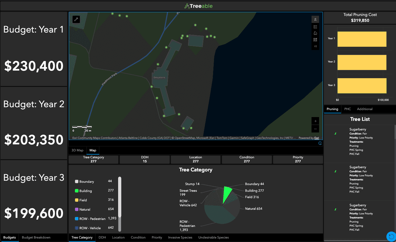
Budget modeling
Compare scenarios, strategies, plans, and budgets.
Loss avoidance
EAL/PML/tail modeling and insurance risk analysis.
Decision outputs
Generate validated, decision-ready analytic layers.
Delivered as
Operations Layer
TreeINT | MANAGE
Assign. Manage. Report.
A canopy operations platform for inventories, inspections, maintenance, crews, vendors, budgets, and stakeholder reporting. One connected system to manage trees from fieldwork to funding.
Dashboards & overview
Real-time insights on inventory, work, budgets, and health.
Inventory & map view
Map every tree with attributes, condition, risk, and history.
Inspections & work orders
Capture field data and schedule crews with visibility.
Maintenance & crews
Track maintenance, crews, vendors, and performance.
Delivered as
The film
See the world's trees become intelligence
A two-minute look at how Treeable observes, understands, and manages individual trees at planetary scale.
Industries
One intelligence layer, every sector that depends on trees
Utilities & Energy
Model vegetation risk to the grid, prioritize trimming, and reduce ignition and outage exposure.
Insurance & Risk
Quantify canopy-driven property risk with EAL, PML, and tail modeling at portfolio scale.
Cities & Government
Run urban forestry programs, justify grants, and report canopy equity with a live source of truth.
Infrastructure & Rail
Protect corridors, right-of-ways, and critical assets from encroaching canopy and failure risk.
Weather
Improve weather intelligence with risk modeling, impact forecasting, and post-event assessment.
Finance & Real Estate
Bring tree intelligence into diligence, valuation, and long-horizon asset planning.
Partners
Backed by the platforms building the future
Treeable is built alongside the leaders in accelerated computing, geospatial systems, and conservation.
Research
Frontier work on the science of Tree Intelligence
Contact
Bring Tree Intelligence to your organization
Tell us about your area of interest and we'll walk your team through DETECT, DECIDE, and MANAGE on your own portfolio.